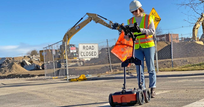
Locating and marking underground utilities in real-time in the field has been a powerful
application of ground penetrating radar (GPR) for many years. A knowledgeable utility
locator with a GPR system as part of their tool box is able to accurately identify buried
utilities. UtilityScan is built for the utility locating professional to accelerate workflow
from target detection to reporting.

Real-time Target Mapping
? Easily pair with your external Bluetooth-enabled GPS,
system includes built-in GPS pole adapter
? Map Mode allows you to trace your steps and gain
a bird’s-eye view of your survey
? Place APWA color-coded marks on your 2D data and
geo-referenced map simultaneously

Advanced Capabilities
? Collect and create 3D scans
? Optional LineTrac®
power detection module to identify
and trace precise location of underground and
RF-induced utilities
Rugged, Flexible System
? Rated IP65 - Durable components tested to withstand
the toughest conditions
? Compact and portable - weighs just 15.4 kg (34 lbs)
? Optional three- or four-wheel survey carts for
challenging survey conditions
UTILITYSCAN FEATURES
Rugged System for Construction Environments
UtilityScan is rated IP65 and built to meet your job site needs.
It can withstand the most challenging survey environments
including rain, dust, and extreme cold down to -20°C (-4°F).
The Panasonic G2 tablet screen is designed for rain and glove
use. For areas where Wi-Fi is prohibited, this system includes
a rugged Ethernet cable that can be used for communication
between the tablet and antenna.

Integrated Advanced Sensor
UtilityScan can be configured with an optional LineTrac®
power
detection module. LineTrac is designed to identify and trace the
precise location of underground electric and RF-induced utilities.
This allows the detected power or induced frequencies data
to be overlaid on the radar data, providing reliable positioning
and target information to the user. These technologies are
integrated into one seamless system to aid in target recognition
and mapping, a first for the utility detection industry.

Real-Time Target Mapping
Map Mode allows users to trace their steps and gain a bird’s-eye view of their survey. Users can also simultaneously place American Public Water Association (APWA) color-coded marks on 2D data and a geo-referenced map. The on-screen 3D data collection mode allows users to easily define the time slice depth and thickness in the field with the 3D data on the screen. The map window can be minimized to view the 3D display full screen.


 Enquiry:hkmarketing@epc.com.hk
  Whatsapp Enquiry: +85261990717


